Wategos Beach, Byron Bay | Top 150 Bikini Destinations

BYRON BAY, NEW SOUTH WALES / AUSTRALIA
Around the headland
Wategos Beach.
Bring a picnic, walk the cape, and leave time for an afternoon in Byron Bay.
Plan your beach day ↘TOP 150 BIKINI DESTINATIONS / NEW SOUTH WALES
A small cove
below the cape.
Wategos Beach curves along the north side of Walgun Cape Byron, about 2 km east of central Byron Bay.
Come for the sand, picnic area, and headland walk. If you want to swim, check the patrol roster and look for red and yellow flags.
ON THE WORLD MAP
On Australia’s New South Wales coast.
Wategos Beach, Byron Bay, New South Wales

01 / GETTING THERE
Start in Ballina or on the Gold Coast.

Byron Bay Solar Train
The heritage train links central Byron Bay and North Beach.
Photo: Jotrain G · CC BY-SA 4.0Get around Byron Bay
Walk the signed coast track from town or drive via Lighthouse Road and Marine Parade. The small paid parking area can fill on busy weekends.
On the beach
The council lists Wategos patrols during the summer and autumn school breaks. Check the current roster, and swim only between the flags. Main Beach has patrols year-round. Beach status ↗
02 / BEACH ESSENTIALS
Know before you go.
You’ll find picnic facilities, drinking water, and restrooms. Pack what you need for a few hours on the sand.
01 / HOW TO GET THERE
From town to Marine Parade
Follow Lawson Street onto Lighthouse Road and look for the Wategos turnoff. Council parking is paid and space is limited. If you’re walking, use the signed coastal track.
Council parking information ↗02 / BEACH ACCESS
A paved approach, then steps
Marine Parade and the picnic-area path are paved. The beach path has 13 concrete steps. The picnic area, restrooms, and promenade are the easier options if you use a wheelchair or have a stroller.
03 / THE SAND
Pale sand and patches of rock
The sandy stretch can narrow as sand shifts around the cape. At the edges, rock and cobbles can be exposed. Keep shoes handy for the walk and give wet rocks a wide berth.
04 / FOOD & WATER
Bring a picnic and refill your bottle
Pick up lunch in town, then use the picnic tables or free barbecues. Drinking water is available at the reserve. Raes is nearby for a sit-down meal.
05 / CHAIRS & UMBRELLAS
Bring your own shade
NSW National Parks lists no on-beach chair or umbrella rentals. Bring a lightweight beach shade, a towel, and any seating you need.
06 / RESTROOMS & SHOWERS
Restrooms, cold showers, and picnic tables
The paved path from Marine Parade leads to accessible flush toilets with a parent and carer changing facility. Cold showers, benches, and free barbecues are also available.
03 / THE BEACH
A day at Wategos Beach.

The curve of Wategos
From above you can see how the sand follows the headland.
Photo: BobTanGo · CC BY 4.001 / ARRIVE
Make time for the tide
Give yourself room to move if the sand narrows as the tide rises.
02 / SWIM
Look for the flags
If patrols are off duty at Wategos, look for red and yellow flags at nearby Main Beach.
03 / WALK
Take the headland track
Bring shoes with grip for the stairs and slopes toward the lighthouse.
04 / PICNIC
Eat by the shore
Carry lunch down from town and take a break at the picnic tables.
Start with a walk on the sand and decide whether you want a flagged swim in town or a longer walk to the lighthouse. If it rains, try a café in Byron Bay or the heritage shops in Bangalow.


04 / NEARBY BEACHES
Four nearby stretches of sand.
Clarkes and Main Beach sit to the west along the bay. Belongil is farther west, and Tallow Beach opens onto the ocean south of the cape.

Clarkes Beach
A sandy stretch between central Byron Bay and The Pass.
- Best for
- A walk along the bay
- Facilities
- Seasonal patrols, nearby toilets, parking, and a café
- Good to know
- Conditions change with swell and tide. Check the patrol list before swimming.

Main Beach
The town beach has an easy walk from shops to the foreshore.
- Best for
- A flagged swim when patrols are on duty
- Facilities
- Lifeguards on the posted roster, toilets, parking, and food in town
- Good to know
- Check the flags and patrol roster when you arrive.

Tallow Beach
The long, exposed shore south of the cape feels different from the cove at Wategos.
- Best for
- A long walk at the Cosy Corner end
- Facilities
- Seasonal patrols, paid parking, and toilets at Cosy Corner
- Good to know
- This open surf beach can have strong rips. Check the patrol location and flags before swimming.

Belongil Beach
Walk the sand northwest of town, where the shore extends toward Belongil Creek.
- Best for
- A walk away from the town center
- Facilities
- Street access and dining nearby
- Good to know
- Avoid the creek mouth and check local signs before you enter the beach.
Distances are straight-line from Wategos Beach. Facilities change by season, so check on the day.
05 / MUST-SEE PLACES
Three ways to see the Byron Bay area.
01 / WALGUN CAPE BYRON
Cape Byron Lighthouse and walking track
Follow the headland loop for ocean views and steep sections of track. Check park alerts before you set out.
NSW National Parks walking track ↗02 / BANGALOW
Bangalow village
Walk the main street past heritage storefronts and stop for lunch. It’s an easy half-day inland from the beach.
Visit NSW’s Bangalow guide ↗03 / NIGHTCAP NATIONAL PARK
Minyon Falls lookout
Look out across the rainforest gorge from the viewing area. Check access alerts before you drive out, especially after rain.
NSW National Parks lookout information ↗EXPLORE THE AREA
Wategos Beach and Byron Bay.
Find Marine Parade on the north side of the cape and trace the walk west toward town or east toward the lighthouse.
Open the interactive map ↗BEYOND THE BEACH
A coast worth walking.
Make time for the headland, a village main street, and a view into the rainforest.

Cape Byron Lighthouse
The white tower sits above the cliffs at Walgun Cape Byron.
Photo: BigTo · CC BY 3.0
Byron Street, Bangalow
Take your time walking the village’s main street.
Photo: Gatoclass · CC BY-SA 3.0
Minyon Falls
The lookout gives you a view into the rainforest gorge.
Photo: Aliceinthealice · CC0
Walgun Cape Byron
From above you can see the lighthouse precinct on the edge of the cape.
Photo: AyanA123 · CC BY-SA 4.006 / SIX HOTELS
Find your base.
MULLUMBIMBY
The Middle Pub
$ Budget · About AUD 119–139 per room per night
Stay above a village pub in Mullumbimby. Check the room type for a private bathroom and plan to drive southeast to Wategos.
The Middle Pub official site ↗OCEAN SHORES
Ocean Shores Motel
$ Budget · About AUD 161–210 per night for a king room or queen suite
Choose a roadside motel with a pool and parking north of Byron Bay. Drive south toward town for Wategos.
Ocean Shores Motel official site ↗BRUNSWICK HEADS
The Sails Motel & Pool Club
$$ Mid-Range · About AUD 215–295 per room per night
A motel with a pool in the riverside village north of Byron Bay. Plan on driving to Wategos.
The Sails Motel & Pool Club official site ↗BANGALOW
Bangalow Guesthouse
$$ Mid-Range · About AUD 280–325 per room per night
Stay in the village for a quieter evening and drive east through Byron Bay to reach the sand.
Bangalow Guesthouse official site ↗BANGALOW ROAD
The Sunseeker
$$$ Upscale · About AUD 330–425 per room per night
A motel with a pool on the south side of Byron Bay. It’s a short drive through town to Wategos.
The Sunseeker official site ↗WATEGOS
Raes on Wategos
$$$$ Luxury · About AUD 1,365–2,818 per suite per night
A small hotel and guesthouses just off Marine Parade. Stay here if you want to walk to the sand.
Raes on Wategos official site ↗

WHEN TO GO
Choose the day you want.
Summer is warmer and winter is milder. Spring can be a good fit for walking and picnics. If you want to swim, choose a beach with flags up and check the council’s current roster. Climate normals ↗
07 / FOOD, LANGUAGE & LOCAL LIFE
From sand to table.

A lunch stop in Bangalow
The main street is a practical place to stop for a bite on a hinterland day trip.
Photo: Gatoclass · CC BY-SA 3.0What to order
Try Australian seafood, a takeaway flat white, or a bakery stop on the way to the hinterland. The area’s restaurant menus change with the seasons.
Local habits
Wear shoes and a cover-up off the sand. Ask before bringing your own drinks, and check each menu for weekend and holiday surcharges.
A LITTLE AUSTRALIAN ENGLISH
Useful on the beach and in town.
- Takeaway
- Food or coffee to go.
- The loo
- The restroom.
- Swim between the flags
- Stay inside the red-and-yellow patrolled swimming area.
- Car park
- A parking lot.
SIX RESTAURANTS
Where to eat.
BYRON TOWN CENTER
Chihuahua
$ Budget · About AUD 13–26 per person for one or two tacos
Order tacos and share a side in the town center. Check the menu before you go.
Chihuahua official site ↗SUFFOLK PARK
Pizza Paradiso
$ Budget · About AUD 14–20 per person for a pizza shared by two
Share a pizza or order a few empanadas on the way back from Tallow Beach. Check the menu for takeaway options.
Pizza Paradiso official site ↗BELONGIL
Treehouse
$$ Mid-Range · About AUD 28–45 for a pizza or main
Stop near Belongil Beach for a wood-fired pizza, fish tacos, or a burger.
Treehouse official site ↗POSSUM CREEK
The Hut
$$ Mid-Range · About AUD 40–60 for a main
Book a hinterland lunch if you want pasta or a main to share. Set menus cost more.
The Hut official site ↗CLARKES BEACH
Beach Byron Bay
$$$ Upscale · About AUD 83–139 for an entrée and main
Reserve a table overlooking Clarkes Beach and see what Australian seafood is on the current menu.
Beach Byron Bay official site ↗WATEGOS
Raes Dining Room
$$$$ Luxury · About AUD 145–195 per person for a set menu
Book ahead for the three-course or tasting menu. Drinks and supplements are extra.
Raes Dining Room official site ↗08 / NEW SOUTH WALES AFTER DARK
Three bars.
Beach Hotel
Stop in for a drink near Main Beach and check the venue’s own listings if you want live music. Beach Hotel ↗
The Railway Friendly Bar
Stop by this pub off Jonson Street and check the venue’s listings for live music. The Railway Friendly Bar ↗
Bangalow Hotel
Try the village pub if you’ve spent the afternoon inland. Check what’s on before you go. Bangalow Hotel ↗
Base yourself in town if you want to walk back from the waterfront. If you’re staying by Wategos or inland, plan your ride home before heading out.


09 / BYRON BAY AREA EVENT CALENDAR & MONEY
Plan around the celebrations.
Byron Bay Ocean Swim Classic
In autumn, the Byron Bay Winter Whales run an organized ocean swim from Wategos to Main Beach. Check the organizer’s course and entry requirements.
Byron Bay Ocean Swim Classic official site ↗Bangalow Show
In spring, the Bangalow Showgrounds host an agricultural show with livestock, ring events, and pavilion displays. Check the organizer’s program.
Bangalow Show official site ↗Currency / Australian dollar
Prices are in Australian dollars (AUD, shown as $ locally). Carry a card and a little cash for small purchases.
Reserve Bank of Australia currency information ↗10 / WHAT TO WEAR
Pack for sand and stairs.
THE WATEGOS KIT
Swim.
Walk.
Stay out.
On the sand
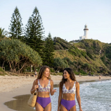
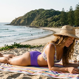
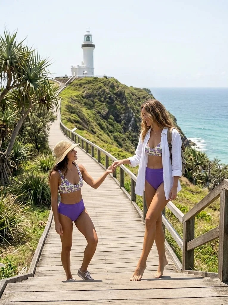
Wear the Wategos Violet — Purple Bloom High-Waisted bikini with a linen shirt and a hat.
On the headland
Wear shoes with grip and bring sun protection and water for the exposed sections.
In town
Add a light layer after sunset and take shoes and a cover-up for dinner.
11 / BEFORE YOU LEAVE
Good to know.
Which airport should I use?
Start with Ballina Byron Gateway for domestic flights and compare Gold Coast if its flight and transfer options suit you better.
Is Wategos good for swimming?
Patrols are seasonal and conditions can change. Swim only between the red and yellow flags. If Wategos has no flags up, check Main Beach.
Is the beach step-free?
The picnic area has paved access and accessible toilets. The paved path down to the sand includes 13 concrete steps.
Can I buy lunch on the sand?
Bring lunch from town for a picnic. The reserve has tables, drinking water, and free barbecues.
Can I visit without a car?
Yes. Use the airport transfer to Byron Bay, then take the coastal track or a local taxi to Wategos.
FOG & FOUNDRY / SWIM
Purple blooms by the sea.
A purple floral print on a high-waisted two-piece.
Explore the matching bikini ↗ Read next · another destination
 Read next · another destination
 Read next · another destination